Stephan van Vuren

Stephan van Vuren

Maximizing Efficiency, Safety, Compliance, and Security in Drone Operations

A drone icon with different AirHub functionalities around it

Business Case for AirHub — Managing large drone operations, especially with teams of 30 or more pilots, requires efficient workflows that save time, reduce costs, and improve safety. AirHub’s software platform provides an integrated solution that allows organizations to optimize their drone operations, combining flight planning, asset management, training, and incident reporting into a single, streamlined platform. This business case outlines the quantifiable benefits of using AirHub, focusing on time and cost savings, enhanced safety, regulatory compliance, and data security.


1. Time and Cost Savings in Flight and Asset Management

Time savings: AirHub significantly reduces the time spent on flight planning, maintenance management, and training administration. Here's how:

  • Flight planning: Without AirHub, flight planning can take up to 45 minutes per mission. Using our platform, this is reduced to just 10-15 minutes, a time savings of over 65%. Additionally, users save at least 20-30 minutes per flight due to faster flight execution, automatic logging, and asset management.

  • For a team of 30 pilots conducting 2 flights per week, saving just 25 minutes per flight amounts to 50 hours saved per week. At an hourly rate of €60, this equates to savings of €3,000 per week, or €156,000 per year.

  • Asset and maintenance management: By automating asset and maintenance management for drones, batteries, and other equipment, AirHub helps organizations save 30% in maintenance-related downtime, preventing unexpected failures that can halt operations.

Cost savings: Beyond time savings, AirHub eliminates the need for multiple software tools. Many organizations pay for separate tools to manage flight planning, incident reporting, asset management, document management, and video management systems (VMS). By integrating these functionalities into one platform, AirHub provides savings of up to €10,000 annually for organizations with 30 pilots, as VMS is often the most expensive standalone tool.


2. Enhanced Safety and Risk Reduction

Improved Safety: Human error accounts for 70% of aviation-related accidents, and drone operations are no different. AirHub helps prevent errors by enforcing standardized workflows and offering built-in features like checklists, risk assessments, and incident reporting:

  • Operational risk reduction: By integrating pre-flight checklists, automated risk assessments, and SOPs, organizations can reduce operational risks by 40-50%.

  • Financial Benefits: Beyond safety improvements, reducing incidents and accidents saves time and money. This includes reducing the costs associated with repairing or replacing drones, downtime due to equipment failure, and insurance premiums, which can be lowered as risk reduction strategies improve safety records.

For example, preventing just one major incident per year (e.g., a lost drone or significant damage to equipment) could save an organization €10,000-20,000 in asset replacement and insurance claims. Additionally, the reduced risk profile can improve insurance premiums, potentially saving thousands of euros annually.


3. Ensuring Compliance and Simplifying Audits

Regulatory compliance: Compliance with aviation regulations is critical to staying operational and avoiding penalties. AirHub helps organizations remain compliant with EASA, FAA, CASA and other aviation authorities by automating flight logging, risk assessments, and documentation management:

  • Audit readiness: AirHub’s automated logs and compliance tools ensure that all flight data, risk assessments, and incident- and maintenance records are captured in real-time, making audit preparation easier. The time to prepare for an audit is reduced by up to 60%, saving dozens of hours per year.

  • Compliments from regulatory bodies: AirHub’s platform has received praise from Civil Aviation Authorities (CAAs) across the globe for simplifying the audit process. This ensures faster audits, fewer compliance issues, and reduced risk of fines or operational shutdowns.

By reducing the time and complexity involved in audits, organizations save money by avoiding penalties and non-compliance fines, which could amount to €10,000 or more annually for large operations.


4. Data Security and Secure Deployment Options

Data security: Security is a paramount concern for organizations dealing with sensitive operational data, especially in governmental and public safety sectors. AirHub ensures that all flight data and sensitive information are protected with secure deployment options:

  • On-Premise and Private Cloud solutions: Organizations can choose to store their data on private clouds or implement on-premise installations, ensuring that sensitive information is kept entirely within their control. This is critical for government agencies and national security operations, where data must remain confidential.

  • Secure Data Mode: AirHub’s Secure Data Mode prevents flight data from being sent to third-party servers, protecting against data breaches and ensuring that sensitive operational information is not exposed to external threats.

By preventing data breaches and ensuring the highest levels of security, AirHub reduces the financial risk associated with data loss, which could cost organizations millions in fines, damages, and reputational harm. For public safety agencies, secure data solutions also help prevent adversaries from accessing sensitive flight data, ensuring national security.


Conclusion: A Comprehensive Solution for Drone Operations

AirHub offers an all-in-one platform that transforms the management of large-scale drone operations by delivering measurable improvements in efficiency, safety, compliance, and security. With AirHub, organizations can:

  • Save up to €156,000 annually by reducing time spent on flight planning and operations.

  • Improve operational safety by 40-50%, reducing the risk of incidents and associated costs.

  • Ensure compliance with 60% faster audit preparation, avoiding regulatory fines and delays.

  • Protect sensitive data with secure deployment options, preventing costly data breaches and safeguarding national security.

For organizations managing large teams of pilots and assets, AirHub provides the tools necessary to optimize operations while reducing operational costs and ensuring the highest levels of safety and security.


For more information or to schedule a demo, visit our website.
Ready to see AirHub in action?

Book a demo and find out.

Related articles

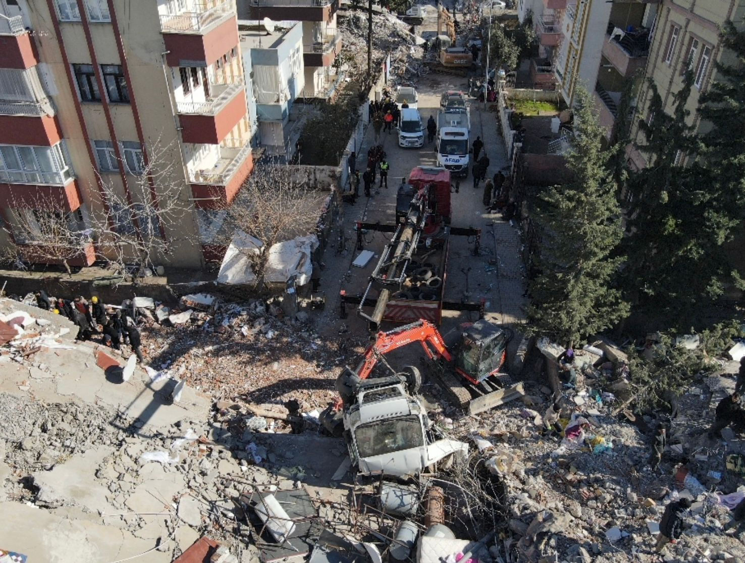
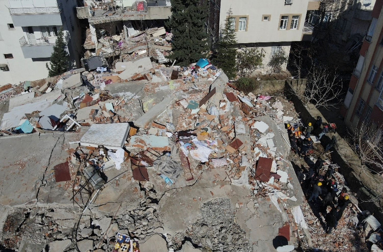
The aftermath of an earthquake

Content

The Impact of the Drone Industry on Workflow in Earthquake Areas

As Drone Hizmetleri we support many sectors, including those of agriculture, security, construction, education, and consulting. Our goal in Turkey is to offer solutions to companies in order to provide the most innovative and up-to-date drone solutions. We continuously strive to create opportunities in new sectors or in the formation of conceptual projects.

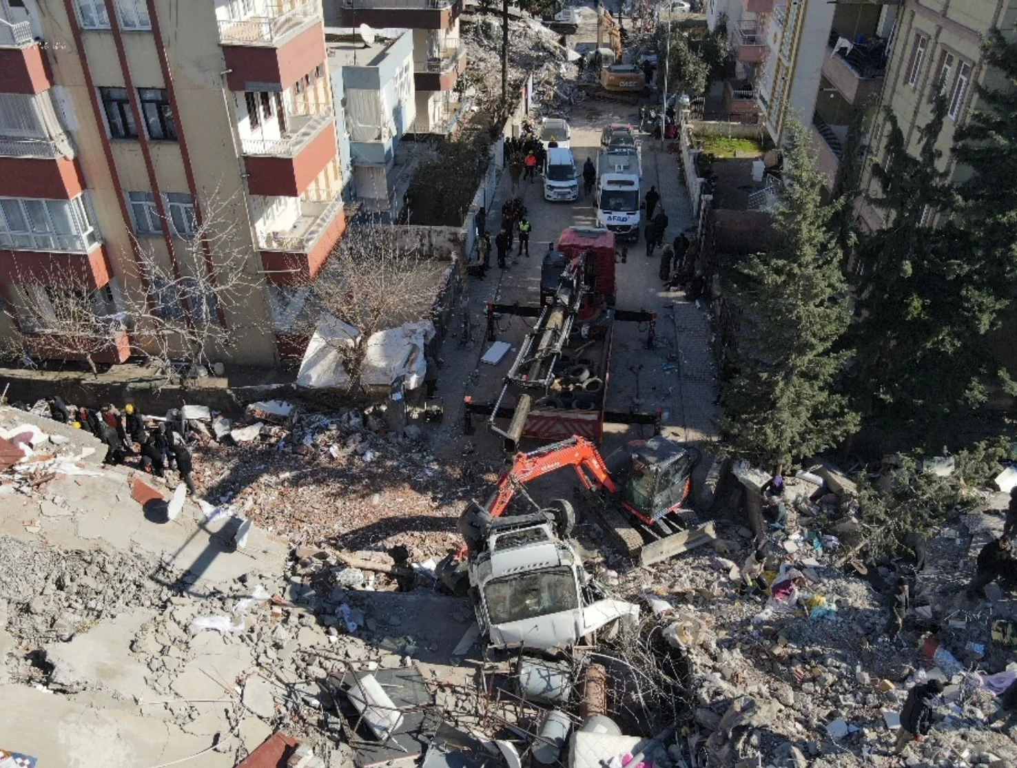
The devastation of the 7.8-magnitude earthquake that occurred in southern and central Turkey on February 6, 2023, and its barrage of strong aftershocks, saw a Turkish government-led response through coordination by AFAD (Turkey’s Disaster and Emergency Management) and the Turkish Red Crescent. State authorities declared a level-4 emergency, leading to a call for international assistance. The Turkish President declared a three-month state of emergency in 10 of the country’s provinces, which resulted in the flocking of organised search and rescue teams, as well as a multitude of individual volunteers willing to help. We, as Drone Services, were in the field as well with our experienced operators and a DJI Mavic Enterprise Dual 2 drone, mounted with a thermal camera, in order to facilitate the task of finding people buried under rubble. Below, the further efficiency in this task is elaborated.


Abstract

Drone use has revolutionised the way in which natural disasters are handled. In particular, the drone industry has had a significant impact on the workflow in earthquake areas. This paper examines the benefits and challenges of using drones in earthquake areas, including their ability to capture high-resolution imagery, deliver medical supplies and rescue materials, and provide real-time data on the extent of damage caused by earthquakes. We also discuss the challenges that arise with the use of drones in earthquake areas, including privacy concerns, air traffic regulations, and limited battery life. Finally, we suggest some ways in which the drone industry can continue to improve the workflow in earthquake areas.


Introduction

Earthquakes are one of the most devastating natural disasters that can occur. They cause immense destruction, resulting in loss of life, property, and infrastructure. Over the years, the drone industry has become an essential tool for emergency responders, providing them with valuable information and assistance during natural disasters. The use of drones has significantly impacted the workflow in earthquake areas. This paper explores the benefits and challenges of using drones in earthquake areas and how they have transformed the workflow.


Benefits of Using Drones in Earthquake Areas

The use of drones in earthquake areas has several benefits. Firstly, drones can capture high-resolution imagery of damaged buildings and infrastructure, providing emergency responders with a detailed assessment of the situation on the ground. This information can be used to prioritise rescue and relief efforts and to allocate resources effectively.

Secondly, drones can be used to deliver medical supplies, rescue equipment, and other essential materials to affected areas quickly. This is particularly important in situations where access to the affected area is limited or where it may be dangerous for human responders to enter.

Finally, drones can provide real-time data on the extent of damage caused by earthquakes, helping emergency responders to make informed decisions about how to allocate resources and respond to the disaster.


Benefits of Using Thermal Imaging Drones in Earthquake Areas

The use of thermal imaging drones has several benefits in earthquake areas. Firstly, thermal imaging technology allows emergency responders to locate survivors who may be trapped in collapsed buildings or other dangerous areas. The drones can quickly scan large areas and identify heat signatures, helping rescuers to prioritise their efforts and focus on areas where there is a high likelihood of finding survivors.

Secondly, thermal imaging drones can identify areas of high temperature, which may indicate a fire or other potential hazards in the aftermath of an earthquake. This information can be used to develop strategies to mitigate these hazards and prevent further damage or loss of life.

Finally, thermal imaging drones can operate at night or in low-light conditions, providing continuous monitoring of the affected area. This can be particularly useful in situations where rescue efforts need to continue around the clock, ensuring that no survivors are overlooked.


Challenges of Using Drones in Earthquake Areas

Despite their many benefits, the use of drones in earthquake areas also poses several challenges. Firstly, privacy concerns may arise when drones are used to capture images of affected areas. It is essential to ensure that the privacy of individuals is respected and that any data collected is used only for emergency response purposes.

Secondly, air traffic regulations may limit the use of drones in earthquake areas. In some cases, airspace may be closed to drones, preventing emergency responders from using them to assess damage or deliver essential supplies.

Finally, limited battery life may pose a challenge when using drones in earthquake areas. In some cases, it may be challenging to recharge or replace drone batteries, limiting their usefulness in prolonged emergency response operations.


Challenges of Using Thermal Imaging Drones in Earthquake Areas

Despite the many benefits of using thermal imaging drones in earthquake areas, there are also some challenges to their use. Firstly, the technology requires skilled operators who are trained in interpreting thermal images. This can be a challenge in situations where emergency responders may be overstretched or have limited experience with drone technology.

Secondly, thermal imaging drones are limited by their battery life, which may be affected by the temperature of the environment in which they are operating. This can make it challenging to keep drones in operation for extended periods, particularly in hot or cold conditions

Finally, privacy concerns may arise when using thermal imaging drones, particularly if they capture images of individuals who are not involved in the emergency response effort. It is essential to ensure that any data collected is used only for emergency response purposes and that the privacy of individuals is respected.


Conclusion

The use of drones has significantly impacted the workflow in earthquake areas, providing emergency responders with valuable information and assistance with the addition of thermal imaging. However, the use of drones in these areas also poses several challenges, including privacy concerns, air traffic regulations, limited battery life, and coming short of skilled operators. However, as we all know, the benefits of drones with and without thermal imaging outweigh these challenges. It is essential for the drone industry to continue to work towards addressing these challenges to ensure that drones remain a useful tool for emergency responders in earthquake areas.

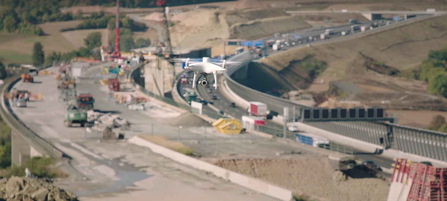
A drone flying over a construction site with regards to regulations

Content

Governmental Policy Guidance

Setting up a national or local policy for drones and Urban Air Mobility requires specific knowledge, not only about the aircraft but also about aviation legislation and procedures.

Drone technology is moving fast and we are looking at a future where packages will be delivered to us through the air and where the transportation of cargo and people in the lower airspace above urban area's will be a common service. So how do you keep as a national legislator or policy maker in an industry that's innovating at such a pace?

AirHub provided us with a comprehensive vision to shape our national roadmap for drones and UAM.

To keep up with the pace of the drone industry you will need a partner that has extensive experience and has specific knowledge available to guide and support you in the development of your policies and regulations.


Implementation of European regulations

At AirHub we are legal aviation experts and we have extensive technical and operational knowledge of (unmanned) aircraft. With our experience and expertise we support Civil Aviation Authorities (#CAA)with setting up their drone policies legislation or guidelines and we help them with the national implementation of the European regulations for drones in the Open, Specific and Certified category.

In the Netherlands for example, we are supporting the Ministry of Infrastructure and Water Management with the development of their national Drone Roadmap and we are the preferred consultant to the Expert Group on Drones, developing all Specific Operations Risk Assessments (#SORA) and Standard Scenario's for #BVLOS operations, operations above congested areas, railways and more.


Development of technical and operational standards

When developing national drone legislation, policies and guidelines you want to set operational standards and limitations for operations in certain geographical zones such as nature areas and other sensitive areas such as around military installations and prisons. You will also want to set technical requirements to the drone and supporting equipment and services.

At AirHub we can help you with the implementation of European guidelines for CE-marking in the Open category in accordance with the EU Delegated Act and the development of requirements for the technical assessment of drones in the Specific and Certified category. You might even consider setting up a Qualified Entity that can give recommendations to your Competent Authority or pilot training, #airworthiness of aircraft and operational #authorization.


Training and checking requirements

When operating drones in the subcategories A1 to A3 in the European Open category the pilot (or operator) will have to verify his/her theoretical knowledge on subjects like legislation and weather before being authorised to operate their drone. At AirHub we can support you in setting up the required question-databank and curriculum for these subcategories. For operations in the Specific category we can provide you with guidelines and standards on theoretical and practical training for operations on all six #SAIL (Specific Assurance and Integrity Levels) levels.


U-Space, e-registration and e-identification

The introduction of U-Space or #UTM will have an enormous impact on our low level airspace. U-space is a set of new services and specific procedures designed to support safe, efficient and secure access to the airspace for large numbers of drones. These services rely on a high level of digitalisation and automation of functions, whether they are on board the drone itself, or are part of the ground-based environment. U-space provides an enabling framework to support routine drone operations, as well as a clear and effective interface to manned aviation, ATM/ANS service providers and authorities.

Many Civil Aviation Authorities and Air Navigation Service Providers struggle with this new concept. At AirHub we have extensive knowledge about U-Space/UTM principles and architecture and we can provide you with a Concept of Operations (ConOps) - including requirements and guidelines for e-registration and e-identification - for the implementation of U-Space in your national airspace.


How AirHub can help

At AirHub we have guided national and local authorities with setting up a legislations, policies and guidelines for drone operations under the European Open, Specific and Certified category. Contact us to take advantage of the experience and expertise of our consultants. They will guide you through all the specifics of this innovative industry.

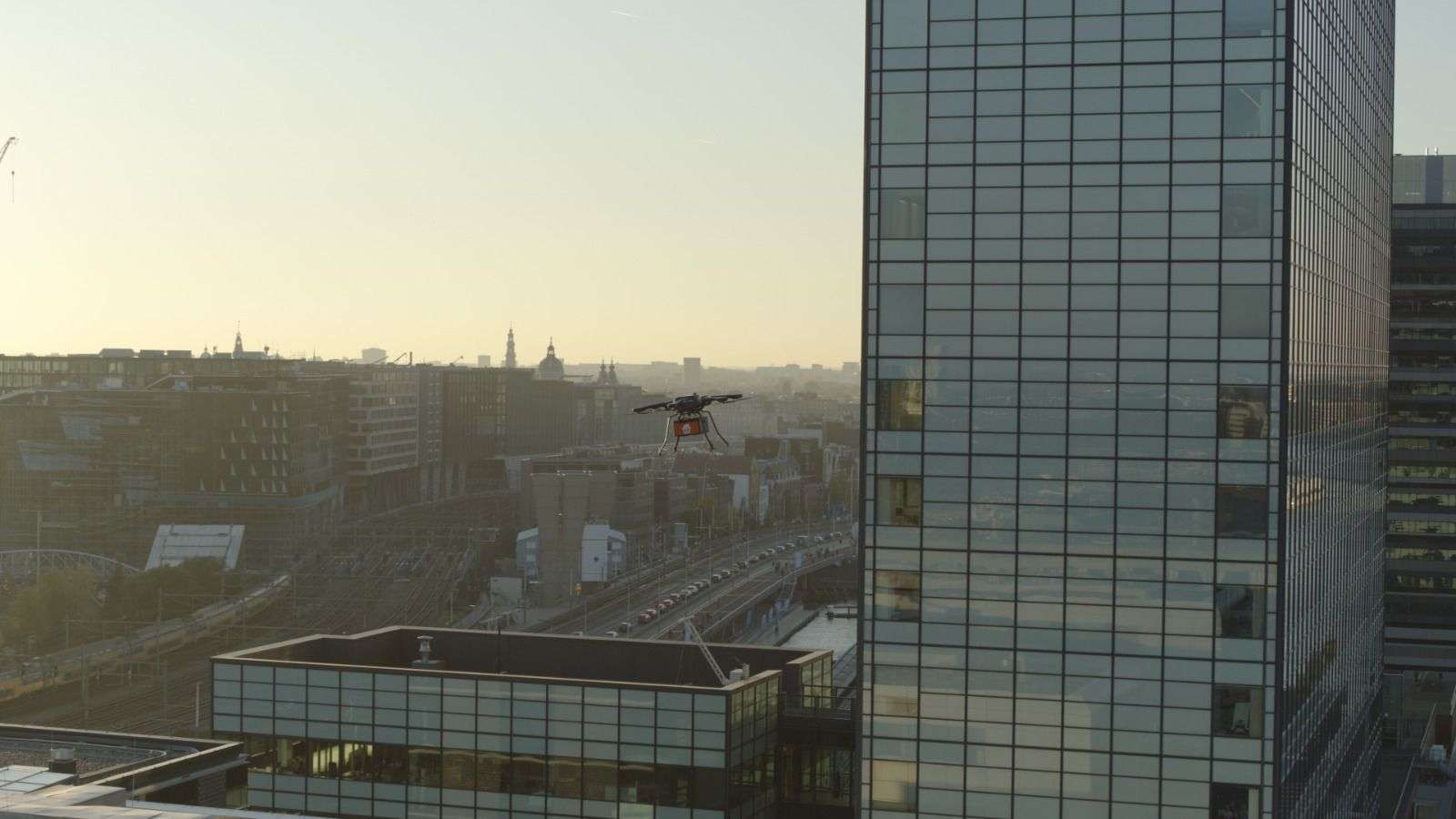
A drone flying over a city next to a glass skyscraper

Content

U-space Exploration Amsterdam

The rapid growth of the drone industry brings forth substantial social and economic benefits, but it also introduces challenges related to the escalating number of drones in our airspace. The complexity of drone operations raises concerns encompassing safety, security, privacy, environmental impact, and more. Addressing these concerns, the implementation of U-space might be a potential solution.

AirHub Consultancy conducted a study on behalf of the Municipality of Amsterdam which is the first step towards developing a plan for the roll-out of U-space above Amsterdam. With the development of U-space above Amsterdam and a potential roll-out, the Municipality of Amsterdam will become a frontrunner at (inter)national level when it comes to the safe integration of drones in the city to enable (new) social and commercial applications.


Objectives

The main objective of the project was to describe the process of implementing U-space airspace above Amsterdam, to identify the potential roles of the municipality and to make a first step with setting up the U-space Airspace Risk Assessment. 


About the Municipality of Amsterdam 

The Municipality of Amsterdam covers the city of Amsterdam as well as a number of small towns. With the growing number of drones, the municipality founded a public-private network organisation; Amsterdam Drone Lab (ADL) to adequately organize the sustainable and safe integration of drones in the city of tomorrow. ADL is constantly looking for cooperation in sustainable and safe applications for unmanned aviation. ADL takes the lead in shaping drone policies within the city and devising urban layouts that facilitate unmanned flights. AirHub Consultancy is partner within this network. Discover another success story showcasing our collaboration with ADL.


https://airhub.app/usecase/be-at-the-incident-before-arriving


Exploring U-space above Amsterdam

Amsterdam wants to integrate drones above the city in a safe and manageable way. U-space can be a means for this. However, this requires proper preparation, in which the municipality can play a central role in the designation of U-space airspace. This exploration includes the formulation of the reasons for designating U-space airspace over Amsterdam and a first step towards performing a U-space Airspace Risk Assessment. 


Reasons for U-space

There are various reasons for Amsterdam to explore the added value U-space offers and therefore reasons to designate U-space. These reasons can be divided into different categories, namely: safety, security, privacy, environment, social and economic. Together with the municipality, we identified the main drivers for Amsterdam to explore the designation of U-space. 


Coordinating the U-space designation

After a request to designate U-space has officially been approved by the competent authority, thereby establishing the so-called Coordination Mechanism, the Municipality of Amsterdam must determine its role. It should be possible for a government, authority or entity to fulfil multiple roles and responsibilities within this mechanism. It is important to guarantee independence, for example by separating departments or teams within the entity. The Municipality of Amsterdam can therefore take on one or more roles during the U-space designation process. AirHub Consultancy identified the different roles and responsibilities of the initiator, U-space coordinator, member of the assessment team but also as a local stakeholder. This will form the basis of moving forward to establishing U-space and particularly the role of the municipality. 


U-space Airspace Risk Assessment

AirHub Consultancy also elaborated the hearing process and started working on a high-level U-space Airspace Risk Assessment. The risk assessment starts with the preparation before moving to the reference scenario and assessment. During the study, the potential of drones has been mapped out and elaborated in a first version of a Concept of Operations. The risks have been identified with a view to this future situation in the airspace above Amsterdam. It follows that without a structured approach, and the eventual roll-out of an air traffic control system such as U-space as a mitigating measure, drones above the city can potentially cause nuisance and danger. The careful development and implementation of U-space is therefore seen as a suitable means of reducing the potential risks to an acceptable level.  

In 2024 AirHub will further explore the potential of U-space with ADL. Stay tuned! Do you want to know more about this case or U-space in general? Contact our U-space consultant Toby Enzerink via toby@airhub.nl