Nerissa Goedhardt

Nerissa Goedhart

Nerissa Goedhart

Marketing Manager

Before joining AirHub, Nerissa spent more than five years shaping content strategy in finance SaaS, leading localised campaigns for CFOs and finance teams across multiple markets. That experience in turning complex, technical subjects into content that actually lands carries straight through into her work at AirHub.

At AirHub, Nerissa leads marketing across the company's markets, making sure content feels right at home wherever it lands. She has a particular focus on customer stories, the moments where a drone mission changes how a team responds to an incident, and she regularly visits customers in the field to capture those stories firsthand. Holding her own drone licence gives her a practical understanding of the operational side of the business, not just the software.

Related articles

Nerissa Goedhart

Pilot in a hi-vis vest holding a drone controller with the AirHub drone operations software app open

Content

Choosing drone operations software: 7 things to check first

Choosing drone operations software is rarely a single decision. It is closer to picking infrastructure: the platform you choose today will shape which drones you can buy next year, which systems you can connect to, and how much manual admin your team carries.

Most comparisons focus on features. Features change every quarter. The things below tend not to, and they are the ones that are hardest to reverse once you have committed.

1. Where your data actually lives

Flight logs, live video and telemetry are operational data, and increasingly, personal data too. Ask where it is hosted, which legal jurisdiction that falls under, and whether the vendor can move it if your requirements change. A platform hosted outside the EU may still be usable, but you should know that going in, not find out during an audit. This is the kind of requirement that public safety and critical infrastructure organisations increasingly treat as non-negotiable during procurement, rather than something to accept on trust, which is worth reading more about in our piece on where European drone software is actually built.

2. Whether you are locked into one drone brand

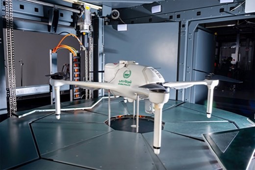
Some platforms are built around a single manufacturer's ecosystem. That can work well if you never plan to diversify your fleet. It becomes a problem the moment you want to add a different drone type, a different dock, or a piece of hardware your current vendor does not support. Ask what happens, practically, if you buy a drone from a different brand next year. Dubai Police's Drone as First Responder network, for example, runs a hybrid fleet across DJI, Skydio and Airobotics hardware through AirHub's fleet management, managed from one interface rather than several separate systems.

3. How it fits with the systems you already run

Drone operations software rarely stands alone. It usually needs to talk to a video management system, a CAD or dispatch platform, or a GIS tool your team already relies on. Ask for a real example of an integration that is live today, not a roadmap item, and ask how much custom development it took to get there. In Dubai, this is what triggers the entire response: an emergency call in the CAD system automatically launches the nearest drone through AirHub's integration, before an officer even picks up the radio. On live operations, video also flows directly into the VMS systems agencies already run, rather than needing a separate viewer.

4. Whether compliance is built in or bolted on

Regulatory requirements, whether EASA's specific category rules in Europe or another framework elsewhere, should shape how the software works, not sit as an add-on report generated after the fact. Ask how the platform handles pilot currency, risk assessments and audit trails day to day, not just what it can export when a regulator asks. EASA's SORA 2.5 update earlier this year is a reasonable real-world test of this: ask a vendor how their platform actually changed when the rules did, rather than only whether it complied with the version that existed when you signed. We broke down what changed for operators in our SORA 2.5 piece, if you want the detail.

5. What happens if you want to scale

A platform that works well for five pilots and two drones does not always work for five hundred pilots across multiple regions. Ask how the vendor's largest customers use the platform today, and what changes operationally between a small deployment and a national one. Bombeiros Portugal runs more than 700 pilots across regions and agencies through AirHub, with pilot certifications and maintenance records staying current across hundreds of decentralised teams rather than sitting in separate local systems. You can read how that's structured in the Bombeiros Portugal case study.

6. Who can access your live video and telemetry

During an incident, live video often needs to reach people beyond the pilot: a control room, a partner agency, or a command vehicle. Ask how access is controlled, whether permissions can be set per role or per mission, and what happens to that footage after the mission ends. Dubai Police runs more than 25 operators coordinating missions simultaneously through AirHub's Drone Operations Center, each seeing what their role needs and nothing more, rather than one shared, unfiltered feed.

7. What deployment options exist beyond the cloud

Most vendors default to a shared cloud environment, which is fine for many organisations. Some cannot use it at all, for data protection or security reasons. Ask whether on-premise or private cloud deployment is genuinely available, or only theoretical. Dubai Police, for instance, runs AirHub as an on-premise, ISO 27001 compliant deployment with encrypted 5G communication, precisely because a shared cloud environment did not meet their data sovereignty requirements. Both on-premise and cloud deployment are documented options, not a custom project quoted separately.

Where to take this next

This article is about knowing which of these seven points matter most for your organisation before a vendor starts talking about theirs.

We have used AirHub throughout to illustrate what a real answer to each point can look like, because these are the questions our own customers asked us before they signed. Dubai Police tested points 2, 3, 6 and 7 directly during procurement: a hybrid DJI, Skydio and Airobotics fleet, CAD-triggered automated launches, role-based access for 25-plus simultaneous operators, and an on-premise, ISO 27001 deployment with encrypted 5G, because a shared cloud did not meet their requirements.

Bombeiros Portugal tested point 5 at national scale, with more than 700 pilots across regions and agencies staying compliant and current through one system rather than hundreds of local ones. Both are covered in more depth in the Dubai Police and Bombeiros Portugal case studies, and the full detail on data residency and security sits on our trust centre.

If you want to work through this checklist against your own operation, book a demo with one of our team.

Drone operations software on a laptop, showing flight data alongside a satellite map with a circular operational boundary

Content

Drone operations software: comparing the main platforms in 2026

If you run a drone programme in public safety, critical infrastructure or security, you have probably already built a shortlist of drone operations software. The market has grown fast, and the platforms on it solve genuinely different problems. Some focus on fleet paperwork and compliance. Others focus on live situational awareness during an incident. Others again are built to turn a network of docked drones into something closer to an autonomous, always-on system.

This guide looks at eight platforms operating in the space today: what each one is built for, who tends to use it, and where it fits.

Fleet administration and compliance platforms

These platforms centre on the paperwork side of running a drone programme: flight logs, maintenance, risk assessments and regulatory reporting.

DroneLogbook

DroneLogbook is a cloud based flight log and compliance management tool. It imports telemetry from most major manufacturers, including DJI, Autel, Parrot and Wingtra, and turns that data into reports for regulators such as the FAA, CAA, CASA and EASA. Alongside logging, it covers maintenance scheduling, incident reporting and a private label option that lets drone manufacturers offer the platform under their own brand. The company states its platform is SOC 2 Type II compliant.

Dronedesk

Dronedesk is a UK platform built around the administrative side of drone operations, scaling from solo pilots to enterprise teams. It brings flight planning, airspace and weather intelligence, checklists, risk assessments, fleet and equipment inventories, flight logging and client admin into a single application, with NOTAM data and what3words location setting included. Flight logs sync automatically from DJI aircraft, with raw log uploads supported for other systems. The company is independently owned and lists users including National Grid for tower and pylon inspection work and Dyfed-Powys Police.

AirData

AirData is a widely used flight data and fleet management platform, with the company reporting more than 444,000 pilots across 232 countries and over 60 million logged flights. It automatically captures flight paths, timestamps, pilot data and battery cycles from the flight apps agencies already use, without requiring a change of hardware. In March 2026 it launched a dedicated Public Safety Program, which the company says spans 60 regions worldwide, including a Public Portal feature that lets agencies such as the Chula Vista Police Department and Las Vegas Metropolitan Police Department publish searchable flight records for community transparency.

Public safety specialists

These platforms are built primarily around the operational reality of first responders: getting a drone in the air fast and keeping command staff informed while it flies.

DroneSense

DroneSense, based in Austin, Texas, is built for law enforcement, fire and emergency response agencies in the US. Its core strength is situational awareness during live incidents: real time video streaming, mapping and collaboration tools for command staff, plus DroneSense Remote, a Drone as First Responder capability that lets a pilot launch and fly a drone from a remote location using onboard sensors and geofencing. The company was founded by former first responders and technologists and offers 24/7 US based support.

DroneControl

DroneControl is a Swiss platform, engineered in Geneva, that started as a secure live streaming and remote control app for public safety teams and has grown into a full operations suite. The flight application is now paired with a web based portal covering pilot, team and fleet management alongside automated flight logging. Its FirstResponder product integrates what3words and Mapbox so that the pilot and any remote viewer work from the same geolocation information during an incident. It supports DJI Enterprise aircraft including the Matrice 4 series, and is used by services such as San Luis Obispo Police Department in California and South Wales Fire and Rescue Service.

Autonomous dock and enterprise platforms

These three focus on drones that fly from fixed docking stations with limited or no pilot present on site, and on managing that at scale.

Drone Harmony

Drone Harmony is built around automated mission planning for complex inspection work, particularly vertical structures, towers and solar sites, using a 3D interface to compute obstacle aware flight paths. It has extended into dock based remote operations, including support for DJI Dock, and offers cloud, on-premise and air-gapped deployment options for organisations with stricter data requirements.

FlytBase

FlytBase, based in Pune,India, describes itself as an enterprise Physical AI platform. Its FlytBase One layer connects docked drones with robots, cameras and sensors under a single control plane, with Verkos AI agents built to detect events in live feeds and trigger automated responses. The platform is hardware agnostic and aimed at large, multi-site deployments in sectors such as ports, energy and city security, with sovereignty and BVLOS compliance named as core design considerations.

DJI FlightHub 2

DJI FlightHub 2 is DJI's own cloud based fleet management and mission control platform, built around DJI enterprise aircraft and the DJI Dock ecosystem. It combines livestreaming, mission planning, mapping and AI object detection in one interface, with data hosted on AWS and ISO/IEC 27001 certification. It is a natural fit for organisations that have standardised on DJI hardware and want a platform built directly around it.

Where AirHub fits

AirHub is drone operations software built in Europe for organisations running structured programmes across three areas: public safety, critical infrastructure and security. Rather than starting from a single drone brand or a single use case, the platform is built hardware agnostic across the four stages of a mission: plan, execute, log and manage, with European data residency built in from the ground up rather than added on afterwards.

For public safety teams, that means mission planning, live video integration with existing VMS systems over RTMP and RTSP, and a Drone Operations Centre app for coordinating multiple aircraft and pilots during an incident. Dubai Police uses AirHub to bring dock to scene response times under 90 seconds across a city wide network, and Bombeiros Portugal runs over 700 pilots through the platform. You can read the Dubai Police case study or the Bombeiros Portugal case study for more detail.

For security operations, AirHub supports perimeter monitoring and live operations for teams such as Dutch Customs, Securitas and Prosegur, using the same fleet and live operations tools available across the platform.

For critical infrastructure operators, fleet management and DJI import features support recurring inspection work across large, multi-site estates, with the same reporting and audit trail expected by public safety teams.

Data residency and sovereignty come up early in most of these conversations, so it is worth reading how AirHub approaches this in our piece on where European drone software is actually built, or checking the details directly on our trust centre.

About this comparison

This comparison was written using publicly available information in July 2026: vendor websites, product documentation, published announcements and independent trade press. Where a figure or capability comes from a company's own material, it is presented as that company's claim.

Drone software moves quickly. Features, certifications, pricing and deployment options change without notice, and several of the platforms here will have released new capabilities since publication. Anyone using this page as part of a procurement process should confirm the current position directly with each vendor before deciding.

AirHub is one of the platforms discussed here, so we have a stake in the subject. We have described the other platforms as their own published material describes them, and we have not compared them on price or on capabilities we could not verify. If you work for one of the companies covered and something here is inaccurate or out of date, email info@airhub.nl and we will correct it.

All product and company names are the trademarks or registered trademarks of their respective owners. Their use here is for identification only and implies no affiliation with, endorsement by or partnership with those companies.

Belgian Police officer and drone pilot reviewing footage on a controller beside a police van during a field deployment.

Content

5 ways public safety agencies are already using drones today

Drone as First Responder programmes are often talked about as something on the horizon. For a growing number of public safety agencies, they are already routine. Here are five ways drones are being used in live operations right now, with real examples from agencies running them at scale.

1. Cutting response times below 90 seconds

Dubai Police built its Drone as First Responder programme around a single target: reaching any incident scene in under 90 seconds, faster than traffic and urban density would normally allow a ground unit to arrive. Emergency calls trigger the nearest drone automatically from a fixed dock, sending live video to the command centre before officers reach the scene. The programme now runs response times as low as 1 minute and 25 seconds, with more than 25 operators coordinating missions through a single interface. You can read the full Dubai Police case study for more detail.

2. Coordinating hundreds of pilots across a national wildfire response

Portugal's Bombeiros run one of Europe's largest public safety drone networks, with more than 700 pilots spread across regions and agencies handling wildfires inland and search and rescue missions along the coast. Bringing that many pilots and drone fleets under one system means thermal feeds from a fire front can reach a command centre in real time, and pilot certifications and maintenance records stay current across hundreds of decentralised teams rather than sitting in separate local systems. As Pedro Tavares, Head of Drone Trainings and Operations at the Escola Nacional de Bombeiros, puts it: "With AirHub, we have a single, secure platform to coordinate hundreds of drone teams across different regions and agencies, whether it's wildfires inland or maritime rescues along the coast." Read the Bombeiros Portugal case study for the full picture.

3. Running multiple drones on one target during a manhunt

A single drone feed only tells part of the story during a pursuit or a large-scale search. The Belgian Police use a layered approach: one drone holds a high-precision zoom on a target while a second maintains a wider overview, with both feeds and flight paths visible to the same command centre at once. That combination has directly contributed to the recovery of missing persons and the apprehension of suspects during live operations. Bram Schoors, Chief Inspector and Drone Pilot at the Federal Police Belgium, describes the outcome plainly: "We have already been able to find two missing persons alive and well thanks to the deployment of the drone via the platform." Kristof van den Broeck, First Inspector, adds that having one platform for the whole workflow matters as much as the flight itself: "The streamed images all converge in one place, and we have a perfect overview afterwards through the log data." See the Belgian Police case study for the details.

4. Giving commanders a live overview during large events

Crowd monitoring is one of the more established public safety uses of drones: a wide aerial view over a stadium, a march or a public gathering gives commanders a perspective ground teams cannot get on their own. Rather than relying on radio reports from officers positioned around a venue, a command centre can watch density build in real time and redirect resources to a specific entrance, exit or pressure point before it becomes a safety issue. The same live feed can be shared with partner agencies working the same event, fire services, medical teams, transport authorities, so everyone involved in keeping an event safe is working from the same picture rather than relaying information second-hand. During multi-day events, that overview also helps commanders plan the next shift's deployment based on what actually happened, rather than what was reported after the fact.

5. Supporting search and rescue at sea and on the coast

Coastal and maritime search and rescue benefits from exactly the combination that makes drones useful elsewhere: fast deployment, a wide search area covered quickly, and thermal imaging that can pick out a person in the water long before a vessel or a ground team would spot them. A drone can be airborne and scanning a stretch of coastline in the time it takes a boat to leave harbour, and thermal cameras keep working after dark or in poor visibility, when the odds for someone in the water fall fastest. Coordinating that with coastguard and lifeboat crews on the water, so the drone feeds directly into the wider response, is what turns a faster search into a faster rescue. The Dutch KNRM, the national sea rescue service, uses drones exactly this way, and you can read how it works in practice in making search and rescue missions more efficient. It is part of why coastal agencies increasingly treat drones as a standard part of the response.

What these have in common

None of these examples are pilot projects anymore. They are operational programmes running every day, at a scale that depends on the same underlying requirements: fast deployment, live video that reaches the right people immediately, and a system that can manage hundreds of pilots and mixed drone fleets without adding administrative weight to every mission.

That is the same foundation AirHub is built on. The platform covers the full mission lifecycle, planning, flying, logging and managing a fleet, hardware agnostic across drone brands and docks rather than tied to a single manufacturer, and built and hosted in Europe. Live video and telemetry reach a command centre through the Drone Operations Center, with automated flight logging and compliance running in the background rather than as separate admin. It is the same platform behind Dubai Police's sub-90 second response times, Bombeiros Portugal's 700-plus pilot network, and the Belgian Police operations described above, for public safety teams working at very different scales.

Pilot in a hi-vis vest holding a drone controller with the AirHub drone operations software app open

Content

Choosing drone operations software: 7 things to check first

Choosing drone operations software is rarely a single decision. It is closer to picking infrastructure: the platform you choose today will shape which drones you can buy next year, which systems you can connect to, and how much manual admin your team carries.

Most comparisons focus on features. Features change every quarter. The things below tend not to, and they are the ones that are hardest to reverse once you have committed.

1. Where your data actually lives

Flight logs, live video and telemetry are operational data, and increasingly, personal data too. Ask where it is hosted, which legal jurisdiction that falls under, and whether the vendor can move it if your requirements change. A platform hosted outside the EU may still be usable, but you should know that going in, not find out during an audit. This is the kind of requirement that public safety and critical infrastructure organisations increasingly treat as non-negotiable during procurement, rather than something to accept on trust, which is worth reading more about in our piece on where European drone software is actually built.

2. Whether you are locked into one drone brand

Some platforms are built around a single manufacturer's ecosystem. That can work well if you never plan to diversify your fleet. It becomes a problem the moment you want to add a different drone type, a different dock, or a piece of hardware your current vendor does not support. Ask what happens, practically, if you buy a drone from a different brand next year. Dubai Police's Drone as First Responder network, for example, runs a hybrid fleet across DJI, Skydio and Airobotics hardware through AirHub's fleet management, managed from one interface rather than several separate systems.

3. How it fits with the systems you already run

Drone operations software rarely stands alone. It usually needs to talk to a video management system, a CAD or dispatch platform, or a GIS tool your team already relies on. Ask for a real example of an integration that is live today, not a roadmap item, and ask how much custom development it took to get there. In Dubai, this is what triggers the entire response: an emergency call in the CAD system automatically launches the nearest drone through AirHub's integration, before an officer even picks up the radio. On live operations, video also flows directly into the VMS systems agencies already run, rather than needing a separate viewer.

4. Whether compliance is built in or bolted on

Regulatory requirements, whether EASA's specific category rules in Europe or another framework elsewhere, should shape how the software works, not sit as an add-on report generated after the fact. Ask how the platform handles pilot currency, risk assessments and audit trails day to day, not just what it can export when a regulator asks. EASA's SORA 2.5 update earlier this year is a reasonable real-world test of this: ask a vendor how their platform actually changed when the rules did, rather than only whether it complied with the version that existed when you signed. We broke down what changed for operators in our SORA 2.5 piece, if you want the detail.

5. What happens if you want to scale

A platform that works well for five pilots and two drones does not always work for five hundred pilots across multiple regions. Ask how the vendor's largest customers use the platform today, and what changes operationally between a small deployment and a national one. Bombeiros Portugal runs more than 700 pilots across regions and agencies through AirHub, with pilot certifications and maintenance records staying current across hundreds of decentralised teams rather than sitting in separate local systems. You can read how that's structured in the Bombeiros Portugal case study.

6. Who can access your live video and telemetry

During an incident, live video often needs to reach people beyond the pilot: a control room, a partner agency, or a command vehicle. Ask how access is controlled, whether permissions can be set per role or per mission, and what happens to that footage after the mission ends. Dubai Police runs more than 25 operators coordinating missions simultaneously through AirHub's Drone Operations Center, each seeing what their role needs and nothing more, rather than one shared, unfiltered feed.

7. What deployment options exist beyond the cloud

Most vendors default to a shared cloud environment, which is fine for many organisations. Some cannot use it at all, for data protection or security reasons. Ask whether on-premise or private cloud deployment is genuinely available, or only theoretical. Dubai Police, for instance, runs AirHub as an on-premise, ISO 27001 compliant deployment with encrypted 5G communication, precisely because a shared cloud environment did not meet their data sovereignty requirements. Both on-premise and cloud deployment are documented options, not a custom project quoted separately.

Where to take this next

This article is about knowing which of these seven points matter most for your organisation before a vendor starts talking about theirs.

We have used AirHub throughout to illustrate what a real answer to each point can look like, because these are the questions our own customers asked us before they signed. Dubai Police tested points 2, 3, 6 and 7 directly during procurement: a hybrid DJI, Skydio and Airobotics fleet, CAD-triggered automated launches, role-based access for 25-plus simultaneous operators, and an on-premise, ISO 27001 deployment with encrypted 5G, because a shared cloud did not meet their requirements.

Bombeiros Portugal tested point 5 at national scale, with more than 700 pilots across regions and agencies staying compliant and current through one system rather than hundreds of local ones. Both are covered in more depth in the Dubai Police and Bombeiros Portugal case studies, and the full detail on data residency and security sits on our trust centre.

If you want to work through this checklist against your own operation, book a demo with one of our team.

Drone operations software on a laptop, showing flight data alongside a satellite map with a circular operational boundary

Content

Drone operations software: comparing the main platforms in 2026

If you run a drone programme in public safety, critical infrastructure or security, you have probably already built a shortlist of drone operations software. The market has grown fast, and the platforms on it solve genuinely different problems. Some focus on fleet paperwork and compliance. Others focus on live situational awareness during an incident. Others again are built to turn a network of docked drones into something closer to an autonomous, always-on system.

This guide looks at eight platforms operating in the space today: what each one is built for, who tends to use it, and where it fits.

Fleet administration and compliance platforms

These platforms centre on the paperwork side of running a drone programme: flight logs, maintenance, risk assessments and regulatory reporting.

DroneLogbook

DroneLogbook is a cloud based flight log and compliance management tool. It imports telemetry from most major manufacturers, including DJI, Autel, Parrot and Wingtra, and turns that data into reports for regulators such as the FAA, CAA, CASA and EASA. Alongside logging, it covers maintenance scheduling, incident reporting and a private label option that lets drone manufacturers offer the platform under their own brand. The company states its platform is SOC 2 Type II compliant.

Dronedesk

Dronedesk is a UK platform built around the administrative side of drone operations, scaling from solo pilots to enterprise teams. It brings flight planning, airspace and weather intelligence, checklists, risk assessments, fleet and equipment inventories, flight logging and client admin into a single application, with NOTAM data and what3words location setting included. Flight logs sync automatically from DJI aircraft, with raw log uploads supported for other systems. The company is independently owned and lists users including National Grid for tower and pylon inspection work and Dyfed-Powys Police.

AirData

AirData is a widely used flight data and fleet management platform, with the company reporting more than 444,000 pilots across 232 countries and over 60 million logged flights. It automatically captures flight paths, timestamps, pilot data and battery cycles from the flight apps agencies already use, without requiring a change of hardware. In March 2026 it launched a dedicated Public Safety Program, which the company says spans 60 regions worldwide, including a Public Portal feature that lets agencies such as the Chula Vista Police Department and Las Vegas Metropolitan Police Department publish searchable flight records for community transparency.

Public safety specialists

These platforms are built primarily around the operational reality of first responders: getting a drone in the air fast and keeping command staff informed while it flies.

DroneSense

DroneSense, based in Austin, Texas, is built for law enforcement, fire and emergency response agencies in the US. Its core strength is situational awareness during live incidents: real time video streaming, mapping and collaboration tools for command staff, plus DroneSense Remote, a Drone as First Responder capability that lets a pilot launch and fly a drone from a remote location using onboard sensors and geofencing. The company was founded by former first responders and technologists and offers 24/7 US based support.

DroneControl

DroneControl is a Swiss platform, engineered in Geneva, that started as a secure live streaming and remote control app for public safety teams and has grown into a full operations suite. The flight application is now paired with a web based portal covering pilot, team and fleet management alongside automated flight logging. Its FirstResponder product integrates what3words and Mapbox so that the pilot and any remote viewer work from the same geolocation information during an incident. It supports DJI Enterprise aircraft including the Matrice 4 series, and is used by services such as San Luis Obispo Police Department in California and South Wales Fire and Rescue Service.

Autonomous dock and enterprise platforms

These three focus on drones that fly from fixed docking stations with limited or no pilot present on site, and on managing that at scale.

Drone Harmony

Drone Harmony is built around automated mission planning for complex inspection work, particularly vertical structures, towers and solar sites, using a 3D interface to compute obstacle aware flight paths. It has extended into dock based remote operations, including support for DJI Dock, and offers cloud, on-premise and air-gapped deployment options for organisations with stricter data requirements.

FlytBase

FlytBase, based in Pune,India, describes itself as an enterprise Physical AI platform. Its FlytBase One layer connects docked drones with robots, cameras and sensors under a single control plane, with Verkos AI agents built to detect events in live feeds and trigger automated responses. The platform is hardware agnostic and aimed at large, multi-site deployments in sectors such as ports, energy and city security, with sovereignty and BVLOS compliance named as core design considerations.

DJI FlightHub 2

DJI FlightHub 2 is DJI's own cloud based fleet management and mission control platform, built around DJI enterprise aircraft and the DJI Dock ecosystem. It combines livestreaming, mission planning, mapping and AI object detection in one interface, with data hosted on AWS and ISO/IEC 27001 certification. It is a natural fit for organisations that have standardised on DJI hardware and want a platform built directly around it.

Where AirHub fits

AirHub is drone operations software built in Europe for organisations running structured programmes across three areas: public safety, critical infrastructure and security. Rather than starting from a single drone brand or a single use case, the platform is built hardware agnostic across the four stages of a mission: plan, execute, log and manage, with European data residency built in from the ground up rather than added on afterwards.

For public safety teams, that means mission planning, live video integration with existing VMS systems over RTMP and RTSP, and a Drone Operations Centre app for coordinating multiple aircraft and pilots during an incident. Dubai Police uses AirHub to bring dock to scene response times under 90 seconds across a city wide network, and Bombeiros Portugal runs over 700 pilots through the platform. You can read the Dubai Police case study or the Bombeiros Portugal case study for more detail.

For security operations, AirHub supports perimeter monitoring and live operations for teams such as Dutch Customs, Securitas and Prosegur, using the same fleet and live operations tools available across the platform.

For critical infrastructure operators, fleet management and DJI import features support recurring inspection work across large, multi-site estates, with the same reporting and audit trail expected by public safety teams.

Data residency and sovereignty come up early in most of these conversations, so it is worth reading how AirHub approaches this in our piece on where European drone software is actually built, or checking the details directly on our trust centre.

About this comparison

This comparison was written using publicly available information in July 2026: vendor websites, product documentation, published announcements and independent trade press. Where a figure or capability comes from a company's own material, it is presented as that company's claim.

Drone software moves quickly. Features, certifications, pricing and deployment options change without notice, and several of the platforms here will have released new capabilities since publication. Anyone using this page as part of a procurement process should confirm the current position directly with each vendor before deciding.

AirHub is one of the platforms discussed here, so we have a stake in the subject. We have described the other platforms as their own published material describes them, and we have not compared them on price or on capabilities we could not verify. If you work for one of the companies covered and something here is inaccurate or out of date, email info@airhub.nl and we will correct it.

All product and company names are the trademarks or registered trademarks of their respective owners. Their use here is for identification only and implies no affiliation with, endorsement by or partnership with those companies.

Belgian Police officer and drone pilot reviewing footage on a controller beside a police van during a field deployment.

Content

5 ways public safety agencies are already using drones today

Drone as First Responder programmes are often talked about as something on the horizon. For a growing number of public safety agencies, they are already routine. Here are five ways drones are being used in live operations right now, with real examples from agencies running them at scale.

1. Cutting response times below 90 seconds

Dubai Police built its Drone as First Responder programme around a single target: reaching any incident scene in under 90 seconds, faster than traffic and urban density would normally allow a ground unit to arrive. Emergency calls trigger the nearest drone automatically from a fixed dock, sending live video to the command centre before officers reach the scene. The programme now runs response times as low as 1 minute and 25 seconds, with more than 25 operators coordinating missions through a single interface. You can read the full Dubai Police case study for more detail.

2. Coordinating hundreds of pilots across a national wildfire response

Portugal's Bombeiros run one of Europe's largest public safety drone networks, with more than 700 pilots spread across regions and agencies handling wildfires inland and search and rescue missions along the coast. Bringing that many pilots and drone fleets under one system means thermal feeds from a fire front can reach a command centre in real time, and pilot certifications and maintenance records stay current across hundreds of decentralised teams rather than sitting in separate local systems. As Pedro Tavares, Head of Drone Trainings and Operations at the Escola Nacional de Bombeiros, puts it: "With AirHub, we have a single, secure platform to coordinate hundreds of drone teams across different regions and agencies, whether it's wildfires inland or maritime rescues along the coast." Read the Bombeiros Portugal case study for the full picture.

3. Running multiple drones on one target during a manhunt

A single drone feed only tells part of the story during a pursuit or a large-scale search. The Belgian Police use a layered approach: one drone holds a high-precision zoom on a target while a second maintains a wider overview, with both feeds and flight paths visible to the same command centre at once. That combination has directly contributed to the recovery of missing persons and the apprehension of suspects during live operations. Bram Schoors, Chief Inspector and Drone Pilot at the Federal Police Belgium, describes the outcome plainly: "We have already been able to find two missing persons alive and well thanks to the deployment of the drone via the platform." Kristof van den Broeck, First Inspector, adds that having one platform for the whole workflow matters as much as the flight itself: "The streamed images all converge in one place, and we have a perfect overview afterwards through the log data." See the Belgian Police case study for the details.

4. Giving commanders a live overview during large events

Crowd monitoring is one of the more established public safety uses of drones: a wide aerial view over a stadium, a march or a public gathering gives commanders a perspective ground teams cannot get on their own. Rather than relying on radio reports from officers positioned around a venue, a command centre can watch density build in real time and redirect resources to a specific entrance, exit or pressure point before it becomes a safety issue. The same live feed can be shared with partner agencies working the same event, fire services, medical teams, transport authorities, so everyone involved in keeping an event safe is working from the same picture rather than relaying information second-hand. During multi-day events, that overview also helps commanders plan the next shift's deployment based on what actually happened, rather than what was reported after the fact.

5. Supporting search and rescue at sea and on the coast

Coastal and maritime search and rescue benefits from exactly the combination that makes drones useful elsewhere: fast deployment, a wide search area covered quickly, and thermal imaging that can pick out a person in the water long before a vessel or a ground team would spot them. A drone can be airborne and scanning a stretch of coastline in the time it takes a boat to leave harbour, and thermal cameras keep working after dark or in poor visibility, when the odds for someone in the water fall fastest. Coordinating that with coastguard and lifeboat crews on the water, so the drone feeds directly into the wider response, is what turns a faster search into a faster rescue. The Dutch KNRM, the national sea rescue service, uses drones exactly this way, and you can read how it works in practice in making search and rescue missions more efficient. It is part of why coastal agencies increasingly treat drones as a standard part of the response.

What these have in common

None of these examples are pilot projects anymore. They are operational programmes running every day, at a scale that depends on the same underlying requirements: fast deployment, live video that reaches the right people immediately, and a system that can manage hundreds of pilots and mixed drone fleets without adding administrative weight to every mission.

That is the same foundation AirHub is built on. The platform covers the full mission lifecycle, planning, flying, logging and managing a fleet, hardware agnostic across drone brands and docks rather than tied to a single manufacturer, and built and hosted in Europe. Live video and telemetry reach a command centre through the Drone Operations Center, with automated flight logging and compliance running in the background rather than as separate admin. It is the same platform behind Dubai Police's sub-90 second response times, Bombeiros Portugal's 700-plus pilot network, and the Belgian Police operations described above, for public safety teams working at very different scales.

Belgian Police officer and drone pilot reviewing footage on a controller beside a police van during a field deployment.

Content

5 ways public safety agencies are already using drones today

Drone as First Responder programmes are often talked about as something on the horizon. For a growing number of public safety agencies, they are already routine. Here are five ways drones are being used in live operations right now, with real examples from agencies running them at scale.

1. Cutting response times below 90 seconds

Dubai Police built its Drone as First Responder programme around a single target: reaching any incident scene in under 90 seconds, faster than traffic and urban density would normally allow a ground unit to arrive. Emergency calls trigger the nearest drone automatically from a fixed dock, sending live video to the command centre before officers reach the scene. The programme now runs response times as low as 1 minute and 25 seconds, with more than 25 operators coordinating missions through a single interface. You can read the full Dubai Police case study for more detail.

2. Coordinating hundreds of pilots across a national wildfire response

Portugal's Bombeiros run one of Europe's largest public safety drone networks, with more than 700 pilots spread across regions and agencies handling wildfires inland and search and rescue missions along the coast. Bringing that many pilots and drone fleets under one system means thermal feeds from a fire front can reach a command centre in real time, and pilot certifications and maintenance records stay current across hundreds of decentralised teams rather than sitting in separate local systems. As Pedro Tavares, Head of Drone Trainings and Operations at the Escola Nacional de Bombeiros, puts it: "With AirHub, we have a single, secure platform to coordinate hundreds of drone teams across different regions and agencies, whether it's wildfires inland or maritime rescues along the coast." Read the Bombeiros Portugal case study for the full picture.

3. Running multiple drones on one target during a manhunt

A single drone feed only tells part of the story during a pursuit or a large-scale search. The Belgian Police use a layered approach: one drone holds a high-precision zoom on a target while a second maintains a wider overview, with both feeds and flight paths visible to the same command centre at once. That combination has directly contributed to the recovery of missing persons and the apprehension of suspects during live operations. Bram Schoors, Chief Inspector and Drone Pilot at the Federal Police Belgium, describes the outcome plainly: "We have already been able to find two missing persons alive and well thanks to the deployment of the drone via the platform." Kristof van den Broeck, First Inspector, adds that having one platform for the whole workflow matters as much as the flight itself: "The streamed images all converge in one place, and we have a perfect overview afterwards through the log data." See the Belgian Police case study for the details.

4. Giving commanders a live overview during large events

Crowd monitoring is one of the more established public safety uses of drones: a wide aerial view over a stadium, a march or a public gathering gives commanders a perspective ground teams cannot get on their own. Rather than relying on radio reports from officers positioned around a venue, a command centre can watch density build in real time and redirect resources to a specific entrance, exit or pressure point before it becomes a safety issue. The same live feed can be shared with partner agencies working the same event, fire services, medical teams, transport authorities, so everyone involved in keeping an event safe is working from the same picture rather than relaying information second-hand. During multi-day events, that overview also helps commanders plan the next shift's deployment based on what actually happened, rather than what was reported after the fact.

5. Supporting search and rescue at sea and on the coast

Coastal and maritime search and rescue benefits from exactly the combination that makes drones useful elsewhere: fast deployment, a wide search area covered quickly, and thermal imaging that can pick out a person in the water long before a vessel or a ground team would spot them. A drone can be airborne and scanning a stretch of coastline in the time it takes a boat to leave harbour, and thermal cameras keep working after dark or in poor visibility, when the odds for someone in the water fall fastest. Coordinating that with coastguard and lifeboat crews on the water, so the drone feeds directly into the wider response, is what turns a faster search into a faster rescue. The Dutch KNRM, the national sea rescue service, uses drones exactly this way, and you can read how it works in practice in making search and rescue missions more efficient. It is part of why coastal agencies increasingly treat drones as a standard part of the response.

What these have in common

None of these examples are pilot projects anymore. They are operational programmes running every day, at a scale that depends on the same underlying requirements: fast deployment, live video that reaches the right people immediately, and a system that can manage hundreds of pilots and mixed drone fleets without adding administrative weight to every mission.

That is the same foundation AirHub is built on. The platform covers the full mission lifecycle, planning, flying, logging and managing a fleet, hardware agnostic across drone brands and docks rather than tied to a single manufacturer, and built and hosted in Europe. Live video and telemetry reach a command centre through the Drone Operations Center, with automated flight logging and compliance running in the background rather than as separate admin. It is the same platform behind Dubai Police's sub-90 second response times, Bombeiros Portugal's 700-plus pilot network, and the Belgian Police operations described above, for public safety teams working at very different scales.