Stephan van Vuren

Stephan van Vuren

SORA 2.5 lands in the rulebook: what the June 2026 Easy Access Rules for UAS mean for critical infrastructure, security and public safety operators

Public safety operator handling an industrial drone on the ground, ready for a SORA-assessed operation

At the end of June 2026, EASA released a new revision of the Easy Access Rules for Unmanned Aircraft Systems (the EAR for UAS). For anyone who works with the specific category on a daily basis, this is the edition worth reading, because it is the point at which SORA 2.5 finally sits inside the single, consolidated reference document alongside Regulation (EU) 2019/947 and its acceptable means of compliance (AMC) and guidance material (GM).

If you have been following the file, none of the underlying content is a surprise. The legal change happened in September 2025, when EASA published Executive Director Decision 2025/018/R and introduced SORA 2.5, the latest version of the Specific Operations Risk Assessment developed by JARUS, into the AMC and GM to Regulation (EU) 2019/947. We looked at that moment when SORA 2.5 first landed. What the June 2026 EAR does is bring that decision, catalogued as Issue 1, Amendment 4 to the AMC and GM, into the one document that most operators and competent authorities actually open when they need an answer. The Easy Access Rules are a consolidation, so no new legal obligation arrives with them. What arrives is readability: three separate publications you used to cross-reference now sit in one coherent, colour-coded, navigable whole.

This post is written for the operators we work with most closely, meaning those flying in and around critical infrastructure, those running security operations, and public safety teams who often sit under their own national regime. Below is what changed, and what it means for each of you.

What actually changed

SORA 2.5 keeps the same fundamental logic as SORA 2.0: you describe your operation, assess the ground risk and the air risk, mitigate what you can, and arrive at a Specific Assurance and Integrity Level (SAIL) that tells you how much evidence you have to produce. What SORA 2.5 adds is a tidier method, sharper definitions, and less friction than operators and authorities met over the first years of practical use.

The methodology is now expressed as ten systematic steps. In outline, you document the proposed operation, determine the intrinsic ground risk class, optionally reduce it to a final ground risk class through mitigations, determine the initial air risk class and then the residual air risk class after strategic mitigations, apply tactical mitigation performance requirements, determine the SAIL, determine the containment requirements, identify the operational safety objectives, and finally compile the comprehensive safety portfolio.

A few points stand out for professional operators:

  • The intrinsic ground risk is now more quantitative. The intrinsic ground risk class is scaled from 1 to 10 and is driven by the unmanned aircraft characteristics, meaning maximum characteristic dimension and maximum speed, together with the population density at risk in the operational volume and the ground risk buffer. This is a more explicit, data-led starting point than many operators were used to.

  • The SAIL still runs from I to VI, and it remains the pivot of the whole assessment. A final ground risk class above 7 falls outside SORA and belongs in the certified category. SAIL V and VI operations require a type certificate issued by EASA under Part 21.

  • The operational safety objectives are consolidated to seventeen. For the assigned SAIL, you show compliance with each of the seventeen OSOs at the required level of robustness, low, medium or high. This is a leaner set than the previous version, and the robustness logic is clearer.

  • Containment is treated as its own function. Step 8 sets containment requirements at one of three robustness levels, low, medium or high, calculated from the unmanned aircraft characteristics, the SAIL, the average population density in the defined adjacent ground area, and the presence of any outdoor assembly of people within one kilometre of the outer limit of the operational volume.

  • The comprehensive safety portfolio replaces the older documentation set. SORA 2.5 also ships with official templates, which is a welcome step towards harmonisation across Member States.

One practical warning on timing. SORA 2.5 became applicable across the European Union on the date ED Decision 2025/018/R was published, 29 September 2025. Individual Member States were permitted to set their own transition windows during which applications prepared under SORA 2.0 would still be accepted, and to define the maximum validity of authorisations granted in that window. Those windows differ by country and several have already closed. If you operate across borders, do not assume a single deadline. Check the position of each national aviation authority you deal with.

What SORA 2.5 means for critical infrastructure operators

This is where the detail rewards close reading, because SORA treats critical infrastructure in a very specific way.

SORA is a safety methodology. Its categories of harm are the potential for fatal injuries to third parties on the ground and fatal injuries to third parties in the air. Damage to critical infrastructure is acknowledged as a genuine and more complex condition, and it is explicitly left out of the quantified part of SORA itself. The reasoning is that different countries have differing sensitivities to this harm, so it is treated as a national specificity and is expected to be assessed in cooperation with the organisation responsible for the infrastructure, which is the party that best understands the threat to its own assets.

There are two consequences for those of you protecting or inspecting energy assets, ports, airports, rail, water, and comparable sites.

First, if your operation could affect critical infrastructure, you complete the SORA risk picture with an additional assessment of the critical infrastructure risk, run in cooperation with the infrastructure owner and folded into your concept of operations. In practice this means an earlier and more structured conversation with the asset owner, and it means your emergency response plan must explicitly account for the possibility of harming critical infrastructure, which the AMC now lists among the emergency situations an operator should plan for. The definition to keep in mind is broad: critical infrastructure means systems and assets vital to national defence, national security, economic security, and public health or safety, at both regional and national level.

Second, when you fly close to sensitive sites, the containment and adjacent-area logic in Step 8 moves to the centre of your assessment. Beyond-visual-line-of-sight inspection routes over or beside a live facility, and drone-in-a-box deployments that hold a fixed operational volume against a fixed asset, are exactly the operations where average population density in the adjacent ground area and the presence of nearby assemblies of people drive the robustness level you have to demonstrate. SORA 2.5 makes those inputs more explicit, which helps, and it also means you need to work the assessment through properly.

What SORA 2.5 means for security operators

For security operations, the same specific-category machinery applies, and there are two things worth separating clearly.

The operation you fly, whether that is perimeter surveillance, a rapid-response deployment, or persistent overwatch of a site, is assessed through SORA in the ordinary way. The site you are protecting may itself meet the definition of critical infrastructure, which brings the cooperation and adjacent-area considerations above directly into your own planning.

It is worth being precise about scope, because it is a common source of confusion. Regulation (EU) 2019/947 and SORA govern how you operate your own unmanned aircraft safely. They do not, on their own, regulate the detection of, or defence against, third-party drones. Counter-UAS sits under a different set of legal instruments, and the security threat posed by an uncooperative third-party aircraft is outside what SORA is designed to quantify. SORA does note that competent authorities may, where appropriate, consider additional categories of harm such as cybersecurity and privacy under Article 12 of the Regulation, and these sit outside the core safety calculation. For those of us building integrated detection, assessment and response capability, the takeaway is that safety compliance for your own platforms and security assurance for the wider site are two distinct workstreams that must be run in parallel and joined up deliberately.

Public safety and the state-operator question

Public safety teams frequently ask whether any of this applies to them at all, and the honest answer is: it depends on how your country has organised itself.

Under the EASA Basic Regulation, Regulation (EU) 2018/1139, aircraft used in military, customs, police, search and rescue, firefighting, border control, coastguard and similar services are treated as state aircraft and fall outside the scope of the EASA framework. Many police and emergency services therefore do not operate under Regulation (EU) 2019/947 directly.

In practice, though, very few Member States have built their state-operator frameworks from a blank sheet. It is far more common for a national authority to construct a regime for state drone operations that borrows heavily from the civil rules, taking large parts of Regulation (EU) 2019/947 and, importantly, its AMC and GM, including the SORA methodology, and adapting them to the operational reality of a state service. Where that is the case, and it is the norm, SORA 2.5 becomes the de facto benchmark even for public safety operators who are formally outside EASA scope. If your national framework references SORA, it will over time reference the current version of SORA, and the ten-step method, the seventeen OSOs, and the containment logic described above will shape how your operations are assessed regardless of the state-aircraft carve-out.

The pragmatic conclusion for public safety operators is to look at how closely your national regime tracks the civil AMC and GM, and to assume that the SORA 2.5 vocabulary is the one your authority and your partners will increasingly speak. Prepare for that language now, whatever your formal status.

What operators should do now

If you take one action from this blog, make it a re-baselining exercise. Concretely:

  • Re-map your existing concepts of operations against the ten SORA 2.5 steps, and identify where the more quantitative intrinsic ground risk and the revised containment inputs change your SAIL or your evidence burden.

  • Confirm the transition position with each national aviation authority you work with. The SORA 2.0 acceptance windows were set nationally and are not uniform. Do not let a live authorisation lapse on an assumption.

  • Adopt the official SORA 2.5 templates and update your internal operations manual, compliance matrix and comprehensive safety portfolio to match.

  • For critical-infrastructure-proximate work, open the conversation with the asset owner early, and build the separate critical infrastructure risk assessment into your concept of operations and your emergency response plan from the start.

  • For security operations, keep the safety case and the security case as distinct but coordinated workstreams, and be clear internally about where the specific-category rules stop and the counter-UAS and site-security regimes begin.

  • For public safety teams, check how your national state-operator framework references the civil AMC and GM, and prepare for SORA 2.5 to become the working language even if you are formally outside EASA scope.

The June 2026 Easy Access Rules confirm the direction of travel and make it official and readable in one place. SORA 2.5 is a genuine step towards a more harmonised, predictable and practical framework for the specific category, and for those of us operating in and around critical infrastructure it brings the risk conversation closer to where it always should have been, which is a shared conversation between the operator and the owner of the asset at stake.

At AirHub we build the software that carries this compliance work through the whole operational lifecycle, from concept of operations and risk assessment to live mission coordination and evidence capture.

If you would like to talk through what SORA 2.5 means for your specific operations, we are always happy to have that conversation. Book a demo and we will walk you through it.

This article is a general overview and does not constitute legal advice. For binding requirements, always refer to the official EASA publications and to the guidance issued by your national aviation authority.

Ready to see AirHub in action?

Book a demo and find out.

Related articles

Multiple drones flying over large buildings with manned aviation in the close proximity

Content

Why to establish U-Space airspace

U-Space represents the next major advancement for the drone industry. It will allow drone operators to conduct a large number of Beyond Visual Line of Sight (BVLOS) operations in complex environments, such as above cities and in controlled airspace. In 2022, the European Union Aviation Safety Agency (EASA) published the European regulatory framework for U-Space, which will take effect on January 26th, 2023. For local authorities, municipalities, provinces, member states, and all other relevant entities that may benefit from U-Space airspace, it is important to understand the reasons for establishing U-Space airspace.


The U-Space concept

As of 2023, member states have the ability to designate U-Space airspace to specific areas of the existing airspace. In U-Space airspace, traffic is controlled by a U-Space service provider, while the traditional air traffic management system (ATM) is still overseen by air traffic controllers. However, the capacity for drone operations is often limited due to the workload of radio communication.

U-Space is defined as a set of specific services and procedures designed to ensure safe and efficient access to airspace. It relies on a high level of digitalisation and automation. Within designated U-Space airspace, four mandatory services will be provided to guarantee safe and efficient operations:

  • Network Identification Service This service provides the identity of operations in U-Space airspace. Moreover, the location and trajectory of the drone during the operation is visible for monitoring and management purposes.

  • Geo-awareness Service With the geo-awareness service, the drone is always aware of the operational environment. Examples of this include airspace limitations (e.g. no-fly zones) or time limitations due to other traffic.

  • Flight Authorization Service Before each flight, the flight authorization service will ensure that the intended trajectory is free of conflicts. It is also referred to as strategic deconfliction.

  • Traffic Information Service During the flight, traffic information service must be provided in the U-Space airspace. If there are any other aircraft nearby, the traffic information service must alert the operator.

These services are provided by the U-Space Service Provider, which is a special company that's been certified and approved. But before U-Space can be used, airspace needs to be designated for it.


Not just for safety

With the increasing number of drones in more complex situations and operations, safety is an important reason to establish U-Space. In the coming years, drone operations beyond the sight of a pilot (BVLOS) will increase, as will the size and weight of the drones themselves. Therefore, the risk of integrating drones into the existing airspace without the introduction of a new traffic management concept will also increase. This risk is particularly significant in complex environments such as airport and heliport environments or populated cities.

However, the reasons for establishing U-Space are not limited to safety. Environmental, security, privacy or economy factors may also necessitate the creation of a controlled airspace for drone operations. From an environmental perspective, limiting traffic density may be a reason, while flights over sensitive sites may be restricted for security purposes.


Taking all stakeholders into account

However, activating U-Space requires authorities to undergo a rigorous process known as the 'Coordination Mechanism.' This mechanism includes conducting an Airspace Risk Assessment, taking into account various data sources and information from stakeholders. Since the reasons for establishing U-Space can vary or may include multiple factors, the process for establishing U-Space considers input from all stakeholders. By incorporating both aviation and non-aviation stakeholders, data can be gathered to design the U-Space airspace in the most efficient manner.

This process within the Coordination Mechanism should culminate in a decision to implement U-Space or not, a "green" or "red" light. Therefore, proper preparation is essential.


How AirHub can assist in the process

With operational and legal expertise and experience in both manned and unmanned aviation, AirHub can assist Civil Aviation Authorities (CAAs), Air Navigation Service Providers (ANSPs), and local governments in the process of establishing U-Space. AirHub can advise on whether U-Space may be a solution for any Safety, Security, Environmental, Privacy or Economy concerns. At AirHub, we have also established a workflow to perform Airspace Risk Assessments in a compliant and efficient manner. In this way, we can support CAAs, ANSPs, and local governments in the process of establishing U-Space. For an example of how AirHub has assisted in a large scaled European project, check out or AMU-LED case.

A manned drone flying above a canal with regards to the Certified Category

Content

The Road Towards the Certified Category

With the EASA regulatory framework that became effective on the first of January this year, UAS operations are divided into three categories. While most drone operators are currently focussing on the Open and Specific Category, many manufacturers and even some operators have started their preparations towards operating in the Certified Category.


What does the Certified category look like?

Operations within this category are classified as unmanned flights with the highest level of risk. So, this category will include all operations where the risk cannot be mitigated to an acceptable level with the risk based approach that is applied through the SORA in the Specific Category. These flights include for example passenger flights, flights over assemblies of people and UAS operations carrying dangerous goods this. These certified operations will be further divided into three types of operations by EASA:

  1. International flights with certified cargo drones conducted under instrument flight rules, similar to current international cargo flights.

  2. Operations in an urban or rural environment in U-Space airspace, which include cargo or passenger flights.

  3. Drone operations with the presence of a pilot on board, comparable with the operations as mentioned in #2. Also, operations within Specific Assurance and Integrity Level (SAIL) V and VI of the Specific Category will fall into this category.


For all of the above mentioned operations, regulations will be very similar to the current legislative framework for manned aviation. So what can we expect?

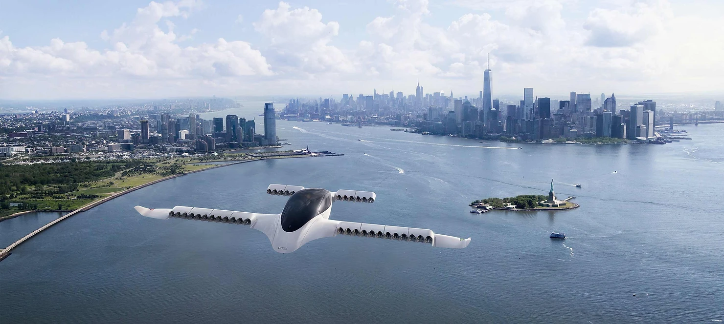
Drones, or electrical Vertical Take-Off and Landing (eVTOL) aircraft, always need a type certificate and a certificate of airworthiness. Furthermore, the operator will need an operational approval, and the remote pilot will need a pilot license. But regulations are not limited to the operator. Since operations need to be facilitated with drone airports, called vertiports, EASA will also set operational requirements for take-off and landing facilities.


What are the next steps?

First, EASA will come up with a opinion that will cover certification aspects for operation type #3 mentioned above, these will also be applicable to UAS operations in the high-risk categories (SAIL V and VI) within the Specific Category. EASA expects to publish this opinion at the end of 2022. Next, a second opinion will be published for both operation types #1 and #2, which is expected to be published at the beginning of 2024.

So It will take some time before a regulatory framework for Urban Air Mobility becomes effective, however, in the third quarter of 2025 (as planned by EASA) the regulations for an unmanned UAM flights will be be published and in effect. Until then, we have to validate the business case for UAM, the technical feasibility and think about the social impact that UAM will have on our society and take the necessary steps to become operational in about five years.


How we prepare ourselves for the Certified Category at AirHub

At AirHub, we are always improving our products and services. Our team of experienced software developers are working on several integrations to facilitate Certified Category operations in our Drone Operations Center in the near future. Together with our partner Altitude Angel, for example, we are working on a full U-Space and UTM integration in both Europe and the United States. In the meantime our consultancy team is already gaining a lot of experience with drone operations in the Specific Category and is preparing for the first UAM flights in the Netherlands as part of the SESAR JU AMU-LED project. And as project manager of the Dutch Drone Delta we are working towards incorporating Urban Air Mobility as a positive, sustainable and accepted, social, economic and environmental form of mobility into society.

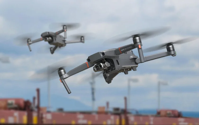
Two drones flying next to each other\

Content

UAS Operations in the Open Category

The EASA regulation for UAS will be coming into force on the 31st of December 2020 and from that moment many commercial drone operations will be conducted within the Open Category. But what types of operation are possible within this category? And what requirements do you have to fulfil when operating within this category?

With the introduction of the European legislation it will no longer be possible for drone operators to apply for an operational authorisation under their national legislation. Instead they will have to fulfil the requirements of the #EASA Open or Specific Category. But how do you determine if your operations falls within the Open Category? And when you can operate in this category, what requirements do you have to fulfil?


Operations within the Open Category

The Open Category is basically a framework that is dived into three subcategories. To determine if your operation falls within one of the subcategories of the Open Category you will first have to check if you can perform your flights within certain limitations, for example:

  • Your operation can only be conducted up to 120 meters above surface level

  • The maximum take-off weight of your drone must be less than 25 kgs

  • Your operation may only be conducted within Visual Line Of Sight (VLOS)

  • You do not carry dangerous goods or drop any material from the drone

  • You do not fly over assemblies of people

If this is the case there is a big chance you can operate within one of the subcategories (A1 - A3) of the Open Category. However, there are a few limitations depending on the weight of your drone. One of the most limiting factors is the safe distance that you have to keep from uninvolved people and urban areas.

The table below provides a clear overview of the three subcategories within the Open Category and the associated weights.

So what can we extract from this table? When we take a closer look we will see that the following types of operations are allowed within the Open Category:

  • Flights over uninvolved people with drones lighter than 900 grams, e.g. flying your DJI Mavic Air within a residential area

  • Flights at a safe distance (more than 30 meters) of uninvolved people with drones lighter than 4 kgs, e.g. mapping a construction site with a DJI Phantom 4 RTK

  • Flights at a safe distance (more than 150 meters) from urban areas (such as residential-, recreational and industrial areas) with drones lighter than 25 kilograms, e.g. performing a coastal surveillance flight with a Matrice 300

As we can see this offers a lot of potential for many different types of operations. However, national (aviation) authorities are allowed to designate certain zones as "Specific Category Only". These zones, for example areas around airports or heliports, will be shown on an airspace map - such as the one available in our AirHub Drone Operations Center. This may limit your operations within the Open Category and force you to operate in the Specific Category.

Now that we know when an operation takes place within the Open Category we will take a look at how you can determine the requirements you will have to fulfil when operating within this category.


General requirements

Operating your drone within the Open Category means you have to abide by some general rules and you will have to fulfil certain requirements. And depending on the subcategory (A1 - A3) you will operate in, additional rules and requirements will apply (which we will explain in the below).

The first thing you have to do when planning to operate your drone in the Open Category is register yourself or your company in the national registry. This is mandatory for all drones that weigh more than 250 grams or have a camera on board (unless it is a toy).

After registering it is time to develop operational procedures that are adapted to the type of operation and the risk involved. As a minimum, these should include:

  • Procedures on how to operate the UAS in accordance with the user's manual provided by the manufacturer, including any applicable limitations;

  • Guidelines to effectively use and support the efficient use of radio spectrum in order to avoid harmful interference;

  • Guidelines how to designate a remote pilot for each UAS operation;

  • Procedures to ensure that the remote pilots and all other personnel performing a task in support of the operations are familiar with the user's manual provided by the manufacturer of the UAS;

  • Competency requirements for the remote pilot(s) and for personnel other than the remote pilot, a description of in-house on-the-job-training courses;

  • Procedures how to check and update information concerning any geographical zones in the geo-awareness system when applicable according to the intended location of operation; g) Procedures how to comply with the operational limitations in geographical zones;

  • Procedures to ensure that the UAS is in a condition to safely complete the intended flight, and if applicable, check if the direct remote identification works properly;

  • Procedures to verify that the mass of the UAS does not exceed the MTOM defined by the manufacturer or the MTOM limit of its class - if the UAS is fitted with an additional payload; j) Procedures to ensure in the case of an UAS operation in subcategory A2 or A3, that all involved persons present in the area of the operation have been informed of the risks and have explicitly agreed to participate.

  • Procedures to observe the operating environment, check the presence of obstacles and check the presence of any uninvolved persons;

  • Procedures to check if the remote pilot is not performing duties under the influence of psychoactive substances or alcohol or if he/she is unfit to perform its tasks due to injury, fatigue, medication, sickness or other causes;

  • Procedures how to keep the drone in VLOS and maintain a how to perform a thorough visual scan of the airspace surrounding the unmanned aircraft in order to avoid any risk of collision with any manned aircraft;

  • A procedure on how to discontinue the flight if the operation poses a risk to other aircraft, people, animals, environment or property; o) If the remote pilot is assisted by a visual observer, a procedure to ensure clear and effective communication between the remote pilot and the visual observer.

  • A procedure preventing the remote pilot to fly close to or inside areas where an emergency response effort is ongoing, unless you have permission to do so from the responsible emergency response services.

  • A procedure to fly higher than 120 meters when operating close to an object (within 50 meters) - up to a maximum of 15 meters above the object on request of the administrator.


When we look at the required procedures above we can distinguish a clear difference between commercial operations - companies with personnel other than the remote pilot - and operations performed for recreational purposes. For recreational operations, operating in accordance with the user manual of the drone will normally be enough, commercial operators however will probably want to set up an Operations Manual for their operation.

Now it is time to take a closer look to the rules and requirements for the three subcategories within the Open Category.


Operations within subcategory A1

As we can see in the table above you are allowed to operate drones with a maximum take-off weight (#MTOW) less than 900 grams in this subcategories. These drones normally have a C0 or C1 CE-marking. The difference however is that, to fly a drone heavier than 250 grams in this category (C1) you will need to complete an online training and test before you are allowed to operate.

And where you are allowed to intentionally overfly uninvolved people with drones C0 lighter than 250 grams, this is not the case for C1 drones between 250 - 900 grams. With these drones there must be reasonable expectation that no uninvolved person will be overflown. And in the event of unexpected overflight of uninvolved persons, you shall reduce as much as possible the time during which the drone overflies those persons.


Operations within subcategory A2

In subcategory A2 you are allowed to operate drones up to 4kg, these drones will have a C0, C1 or C2 CE-marking - the latter are the ones between 900 grams and 4 kg MTOW. When flying a C4 marked drone you will have to make sure the UAS operations takes place at a safe horizontal distance of at least 30 metres from uninvolved people. However there is an exemption to this when you operate with an activated low-speed mode (max 3 m/s). In this case the minimum distance is reduced to 5 meters when the weather conditions, obstacles in the area and performance of the drone allow it.

Just like when operating a C1 drone in the A1 subcategory, you will need to complete an online training and test to operate with C2 drones in the A2 category. However, you will also need to complete a practical self training and a theoretical test at a recognised (governmental) facility.


Operations within subcategory A3

Again looking at the table above we see that the A3 subcategory is a little bit more restrictive than the other subcategories but that it allows you to operate much heavier drones - up to 25 kgs. These drones will be marked with either a C0 to C4 CE-marking, but you are also allowed to operate drones that have been privately build (e.g. model aircraft).

Flights within this subcategory have to be conducted in an area where the remote pilot reasonably expects that no uninvolved person will be endangered within the range where the unmanned aircraft is flown during the entire time of the UAS operation. This means you have to keep a safe horizontal distance of at least 150 metres from residential, commercial, industrial or recreational areas.


Fulfilling the requirements

Now that you know how to assess if your operations falls within the Open Category and you know how to determine the requirements and rules applicable to your operation it is time to fulfil these rules and requirements. So how can you do this? This is were we come in at AirHub.


How AirHub can help

At AirHub we have guided many organisations across various industries with setting up a safe, efficient and compliant drone operation. Contact us to take advantage of the experience and expertise of our consultants and trainers. Our consultants will help you with setting up procedures specific to your operation. Our trainers will help your crew get certified and will train them in safely conducting your type of operation. And with our AirHub Drone Operations Management platform you will be able to efficiently plan, execute and manage your drone operations.